
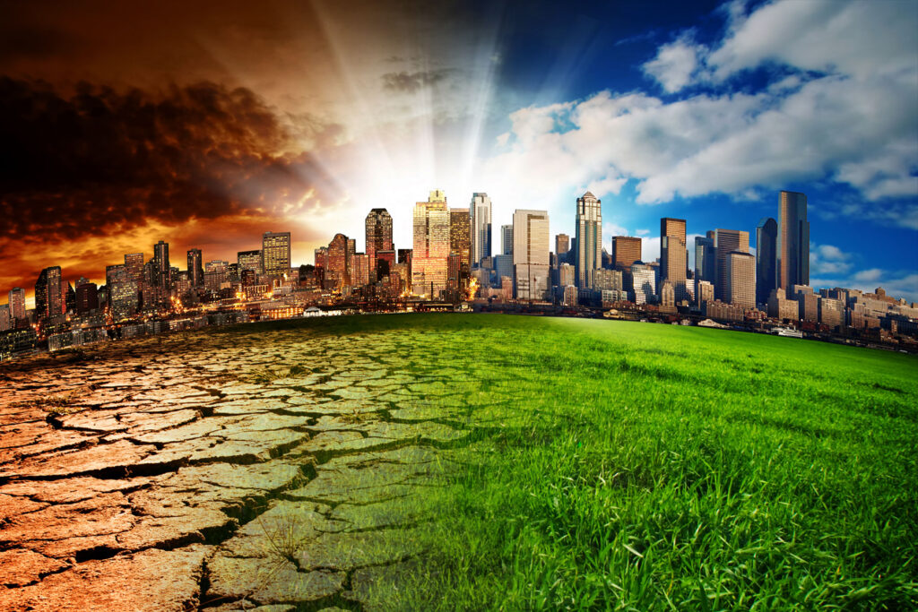
Benefits of Geospatial Technology for the Environment
It’s not new that environmental issues are now receiving more attention on a global scale. The speedy rise of human economic activities has created all the required conditions for an ecological crisis. In this context, modeling, and forecasting the evolution of the situation gets significant relevance. Not only that but it also includes the direction connected with the quantitative assessment of anthropogenic influences on the environment and the invention of a system for the estimation of the ecological situation’s state. And the creation of such a system is not possible without the use of modern geospatial technology.
What is geospatial technology?
Such technology enables spatial mapping. Besides, it includes the study of changes to the Earth’s surface and human societies. Thanks to the advances in computer and space technology, the possibilities are infinite. Due to the development of modern satellites, high-resolution Earth imaging is now possible. Whereas the associated digital software, maps, and data sets on socioeconomic and environmental phenomena allow computers to efficiently store and share these images. This makes it possible to layer a set of maps with geographical data for later research and sharing. So, if you want to know more about how one can use geospatial data to the advantage of various sectors, click here.
In this article, we’ll focus on how geospatial technologies help protect the environment. So, let’s just take a quick look at the various types of geospatial technologies in use.
Different types of geospatial technologies
Below are the major categories of geospatial technologies:
- Geographic Information System. GIS is a collection of software applications for mapping and analyzing geo-referenced data. You can use it to identify spatial trends in other types of data. For example, poor water availability or disease clusters brought on by toxins.
- Remote Sensing. This relates to pictures and other information gathered by satellites, aircraft, and sensor platforms. For instance, modern commercial satellites can deliver photos with a one-meter or smaller level of detail. That then enables more accurate and precise monitoring.
- Global Positioning System. A constellation of satellites known as GPS was originally created for military use. However, now we use it on a daily basis for a variety of reasons. GPS provides exact coordinate locations.
- Internet Mapping Technologies. These all indicate software programs designed to change how we perceive and share geographical data. Google Earth is the most well-known example of one of these tools. Additionally, these technologies are getting easier to use as a result of advancements in user interface design, making them more accessible to a larger audience.
Top 2 ways in which geospatial technology is helping the environment
Here are the top 2 benefits of geospatial technologies for the environment.
#1. Sustainability and geospatial technologies

Geospatial technologies allow experts to produce maps that show all kinds of changes to the earth’s landscapes. They can identify the borders of nations, streets, and residences. Moreover, the list includes hydrology, forests, farms, and areas of land that are vulnerable to flooding or other natural calamities.
By using geospatial technologies one can successfully produce maps of important environmental characteristics. These maps are later used to determine the scope and rate of flora and fauna decline in response to fresh data. You can also use them to track local and global anthropogenic impacts. It can be done by adding data from remote sensing, particularly satellite, and traditional field observations. Moreover, it is possible to check the condition and rate of environmental degradation by using the test areas marked on all map layers.
Also, modeling the effects and spread of pollution in the atmosphere and in the hydrological network is very simple with the use of GIS. One can also overlay the results of model calculation on maps of the natural world, such as those showing the local vegetation, or maps of residential areas. As a result, it can evaluate the effects of persistent points and area pollutants. Meanwhile, it also shows the immediate and long-term effects of such extreme scenarios. For example, the release of oil and other dangerous substances.
How does it benefit the environment?
Tracking the effects of actions taken at the local and regional levels is one of the key applications of geospatial technologies. This is all thanks to the expansion and improvements in environmental protection measures. We can gather updated data from ground surveys, remote observations from aircraft, or data collected from space. Additionally, you can use GIS to monitor local species’ living conditions. It can identify causal relationships and chains, and evaluate the positive and negative effects of environmental protection measures on the ecosystem as a whole and its individual components. Moreover, it can make operational decisions about corrections based on shifting external conditions.
All this enables a sophisticated examination of the environmental effects of various human activities. With the ability to recognize and evaluate such impacts, individuals can take steps to lessen their negative effects. This will eventually help us move towards sustainability in many contexts.
#2. Climate change and geospatial technologies
Geospatial data is particularly helpful at all scales. It extends from the global to the local areas, and we can use it for a variety of use cases. For example, in the following terms of monitoring climate change:
- Forecasting the weather based on climate models and monitoring local weather patterns. While it also helps in monitoring seasonal patterns, and climate systems (such as the El Nino effect)
- Tracking of urbanization, as well as pollution and/or gas emissions from cities and factories
- Monitoring of natural catastrophes and their implications on mitigation
- Mapping of land use and deforestation
- Power usage illustration
- Examination of carbon footprints
Currently, one of the main problems with climate change is how it affects transportation infrastructure in various ways. For example, as Earth’s average temperature rises, infrastructure degradation speeds up. Heavier precipitation increases the chance that roads will flood. Meanwhile, sea level rise increases the possibility that infrastructure will be flooded. On the other hand, storm intensity and frequency may cause serious infrastructure damage.
Therefore, transportation businesses already have to account for the probability of climate change-related disasters when making plans to reduce effects and improve infrastructure resilience. They are doing this by examining alternative adaptation technologies. These technologies using GIS tools will help them to deal with future climate conditions and identify the weaknesses in the transportation system using. For example, they can choose the optimal routes for road building and mapping. It will reduce the fear of damage due to climate-related accidents.